Longitude – Dava Sobel

The fourth week of August, and Cook only did three voyages of exploration so what to do here, well as the second voyage carried watches to test new ways of calculating longitude with varying levels of success as I will cover below it only seems fair to delve deeper into just what was being tested and why, fortunately Dava Sobel has written this excellent summary of just what was going on and how a group of astronomers colluded to keep John Harrison and his son William from winning the main prize.

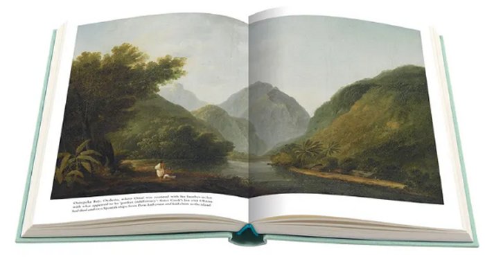
As I said a couple of weeks ago “Cook had a watch made by Larcum Kendall which was a copy of that designed by John Harrison and alongside this a watch made by John Arnold, Ferneaux had two watches made by Arnold,” It may seem odd that the original clock by Harrison didn’t go on the 1772 voyage seeing as he was the one in line for the £20,000 prize (over £2.5 million for the modern equivalent according to the Bank of England inflation calculator) but the Board of Longitude were by then determined that he shouldn’t succeed and insisted that the original was effectively held hostage by them whilst a, hopefully inferior, copy was sent instead. But we are getting ahead of the story, let’s go back a few decades.

Dava Sobel presents the development of H4, the superb watch made by Harrison, by starting at the very beginning with explaining the problem of determining longitude. How far up or down the Earth you are is relatively easy to determine but longitude, how far round the Earth from your start point is a lot more difficult as you either need complex astronomical readings and their subsequent calculations and it could easily take four hours to work out where you roughly are using that method; or an accurate indication of the time in your home port to compare with local time which you could get from when the sun was highest in the sky which would be noon. Local time changes as you go round the world with a full twenty four hours representing a circumnavigation so an hour difference would be equivalent to fifteen degrees of longitude away from home. The problem was that no clock would work accurately on a ship due to temperature and humidity changes along with the movement of the ship and it had to be accurate as just a minute out would drastically alter the determination of longitude.

John Harrison, a self taught clock maker from the north of England starting to construct his first clocks back in 1713, a year before the Longitude Act setting out the prizes for determining longitude was passed. His clocks were, most unusually, mainly made of wood rather than the more common brass and most still exist with his fourth, the clock at Brocklesby Park, built in 1722 still running and telling excellent time today. Harrison’s first encounter with the Board of Longitude would be in 1730 when he went to London to present his early plans but he couldn’t find them as they had yet to meet due to no sensible proposal being sent for them to consider. That it took until 1773 for him to be finally awarded half the money he was fully entitled to and then only following intervention by the King is a scandal that Sobel covers so well in this book. Admittedly Harrison himself was partly to blame for the delay as he kept seeing improvements he could make and wanted but most of the problems were down to astronomers, especially Maskelyne, who were determined that solving longitude via lunar observations was the only way forward and as they were on the Board they kept changing the rules in order to prevent Harrison winning.

The story of the determination of longitude sounds like a fairly dry subject but it is anything but and this is one of the most interesting books I have read this year.

The Third Voyage – Captain James Cook

Before his third, and final, voyage Cook was formally given the rank of Captain and was officially retired, assigned to Greenwich Hospital at the age of just forty seven. He accepted this transfer off active duty on the basis that he would be allowed to come back and this he duly did, taking command of the apparently refurbished HMS Resolution in 1776. This time he was tasked to head north in search of the fabled North-West Passage which would give a route above the top of Canada between the Atlantic and the Pacific oceans. This had been sought for many years starting from the north Atlantic, Cook’s instructions was to start off Alaska and see if the route could be discovered coming in the opposite direction. Charts at the time for this part of the world were poor to say the least with one of the maps showing Alaska as a giant island off the coast of Canada although the Danish explorer Vitus Bering had discovered the Strait that bears his name many decades earlier whilst in the employ of the Russian navy.

In the absence of any alternative route Cook headed south to go north as he first had to enter the Pacific. The first thing that strikes the reader as we head back to familiar territory of New Zealand, Tonga and Tahiti is that the book is written in a very different style compared to the first two voyages. Instead of the formal naval journal with each day detailed with position, wind speed, heading etc. we get a manuscript that is far more aimed at the lay reader where a lot of the technical information is dispensed with and it reads much more like a diary. I have checked this with the full 1784 first edition to make sure that this style is not just a creation of the abridgement and that book is also in this more readable style so Cook was clearly aiming at publication from the start. Sadly he was never to see the book come out as he was to die on this voyage and never return to England but the manuscript that was to be published was just 17 days behind when he died so he must have been constantly working on it whilst at sea.

Cook had another reason to go to the South Pacific and that was to return Omai, a native of one of the islands with Tahiti who had travelled back on HMS Adventure as part of Cook’s second voyage. Omai was the first Polynesian to visit Europe and had achieved celebrity status whilst he was there and his return was the publicly stated reason for the trip as the search for the North West Passage was kept secret. It took longer to get to the South Pacific than intended so Cook decided that by the time he headed north it would be too late to attempt the search so stayed in the southern summer before heading north the next year and on his way became the first European to encounter Hawaii, or the Sandwich Isles as he named them after the then First Lord of the Navy, Lord Sandwich. Cook’s two ships HMS Resolution and HMS Discovery, commanded by Captain Charles Clarke, arrived at an opportune time as the islanders believed that their god was due to arrive at pretty well the same time as Cook did so they were treated royally and the elaborate ceremonies are described in the journals. When he finally left to continue north he was somewhat later than the predicted date for the god’s departure and the islanders were getting a little annoyed that he had not gone according the the plan.

Cook then headed north sighting Oregon and then following the coast of Canada, all the way to the Bering Strait producing the first accurate maps he then went east across the top of Canada before being stopped by ice bu which time he had gone past 70 degrees north. Turning round he headed west and continued on that heading, mapping the Siberian coast of Russia before again being stopped and having to go back to the Bering Strait. By then it was September and nothing more could be done so far north so he decided to return to Hawaii where they had been so welcome. The ships stayed for a month and were again welcome but soon after leaving a mast broke and knowing nowhere else he could go to effect repairs Cook went back to Hawaii and this time he was definitely not expected, Lomo was supposed to appear then leave and not come back again so soon and relations between the islanders and the ship’s crew rapidly deteriorated leading to the killing of Cook.

Now at this point the two versions of the book I have separate as the first edition is just two volumes in to a three volume set, the third volume being written by Captain King, whilst the Folio edition pretty well stops here presumably as the set is called the Journals of Captain Cook and he is now dead. The three books that make up the Folio set are however an excellent summary of what should in fact be a much larger nine volume set if you had the full version but it is no less good for that. Anyone interested in voyages of exploration should definitely read Cook and this is one of the most approachable editions being beautifully typeset and therefore a pleasure to read. One oddity of the images that I have used from the Folio Society web site is seen below as the picture of the included maps appears to show them in the middle of the book whilst they are in fact at the front of each volume.

The Second Voyage – Captain James Cook

Continuing with the voyages of Captain James Cook, the second trip had much greater funding than the first and Cook had charge of two vessels, Resolution and Adventure with Cook leading from HMS Resolution and HMS Adventure captained by Tobias Furneaux. They were charged with trying to discover the supposed great southern continent then known as Terra Australis, modern day Antarctica as opposed to Australia which was called New Holland at the time. It was believed by many scientists that such a mass of land must exist, if only as the source of the icebergs. The other thing that Cook and Furneaux were to study was on behalf of the Board of Longitude. Calculating latitude, how far up or down you are in the world was relatively easy however longitude, how far round the world you are, was much more difficult and ideally needed accurate knowledge of the time back where you started and clocks and watches were highly susceptible to temperature and climate variations. Cook therefore had a watch made by Larcum Kendall which was a copy of that designed by John Harrison and alongside this a watch made by John Arnold, Ferneaux had two watches made by Arnold, these were to be tested at sea and their accuracy determined, Cook and Ferneaux duly set off in May 1772. I’ll be reading more about the search for accurate longitude in the fourth book of this months theme ‘Longitude’ by Dava Sobel.

Cook duly sailed south and spent months skirting ice fields, with the two ships becoming on the 17th January 1773 the first from Europe to cross the Antarctic Circle and the following day getting to seventy five miles from the continent itself but without spotting land due to the amount of ice between them and Antarctica. Cook describes himself as surprised that the ice they recovered from the ocean in order to replenish the ships water stocks was fresh with only a small salty coating which would soon melt off and wonders how sea water freezes without retaining salt without realising that this is proof of fresh water glaciers further south that have broken off and are simply floating past the ships. One interesting quote a few days earlier gives an idea as to how the crew were faring in the extreme cold again featuring Cook’s idiosyncratic approach to spelling.

Monday 4th January 1773: First and middle parts strong gales attended with a thick fogg, sleet and snow, all the rigging covered with ice and the air excessive cold, the crew however stand it tolerably well, each being clothed with a Fearnaught jacket, a pair of trowsers of the same, and a large cap made of canvas and baize, these together with an additional glass of brandy every morning enables them to bear the cold without flinshing.

Cook would make another trip south in December 1773 after spending time in New Zealand along with Tahiti and Tonga amongst others repairing and re-equipping his vessels, and indeed getting back with HMS Adventure as the two ships had lost one another in thick fog in February 1773. Fortunately anticipating such an occurrence there had agreed to meet at New Zealand if they parted in the Antarctic ice. This trip round the South Pacific islands enabled Cook to also reacquaint himself with people he had met on his first voyage and pass on the bad news that the islander who had accompanied Cook on that voyage had sadly died on his way from Indonesia to South Africa and had therefore never seen Europe.

The second trip in search of Antarctica was no more successful than the first and Cook became convinced that there was no great southern continent, what he did however prove was that none of the lands known and partly mapped reached down through the ice to the far south. Indeed there would be no confirmed landing on Antarctica until the Norwegians got there in 1895 but to my surprise Cook is definitely a pioneer of Antarctic exploration getting far further south than anyone else in his time, something I hadn’t realised until I read this book. I had always though of Cook sailing in warmer climes so to read the battles with ice in this volume was fascinating but by February 1774 he finally turned north again eventually arriving at Easter Island in the hope of trading for more supplies. However Easter Island was to be a disappointment, the rich fertile land described by the first European visitors, the Dutch, in 1720 had gone and the people were reduced to a subsistence existence, the population also appeared to be greatly reduced, clearly something had happened here but Cook didn’t have the time, or the inclination, to find out what as he needed supplies so headed back to Tahiti.

Cook would make a further attempt to head south in 1775, this time in the South Atlantic having passed the southern tip of South America and would briefly visit South Georgia. By this time although he still hadn’t seen land to the far south he was convinced there was something as he had realised that it was needed to be a source of the ice. He wrote on 6th February 1775:

We continued to steer to the south and SE till noon at which time we were at the Latitude of 58 degrees, 15 minutes South, Longitude 21 degrees 34 minutes West and seeing neither land nor signs of any. I concluded that what we had seen. which I named Sandwich Land was either a group of islands or else a point of the continent, for I firmly believe that there is a tract of land near the Pole, which is a source of most of the ice which is spread over this vast Southern Ocean.

From the South Atlantic Cook finally turned north and sailed back to England, arriving in July 1775. The illustrations shown above are from Tanna, in the New Hebrides, now Vanuatu including a portrait of a native islander whilst below is the map that comes with this set which folds out to quite a good size.

The First Voyage – Captain James Cook

August is the month I read a theme and this year I have decided to tackle the journals written by James Cook describing his various voyages round the world. To do this I am starting off with the excellent abridged collection published by The Folio Society which is based on the JC Beaglehole version first published by The Hakluyt Society between 1955 and 1967. Beaglehole went back to Cook’s original manuscripts and ships logs and especially for the first voyage removed a lot of the extraneous material added by the Admiralty’s appointed editor which so annoyed Cook when he first saw the published work when he returned from his second voyage.

The barque HMS Endeavour set sail in August 1768 with 94 people aboard on what would be an almost three year voyage of exploration, both geographic and scientific as amongst the ships passengers were the eminent naturalist and Fellow of the Royal Society, Joseph Banks, and astronomer Charles Green specifically there to observe the transit of Venus from Tahiti. There were also other scientists to assist in the collection of specimens and a couple of artists, Sydney Parkinson and Alexander Buchan, sadly neither of which survived the trip. First port of call after leaving England was the island of Madeira for further provisions and where amongst other things they took on 3,032 gallons of wine (presumably the local fortified variety), twenty pounds of onions per man, 270 pounds of beef and amazingly a live bullock. I dread to think how killing the beast and its subsequent butchery were accomplished whilst crossing the Atlantic to Brazil on a crowded ship which was less than 100 feet (30 metres) long.

The first target destination was Tahiti for the observation of the transit of Venus due on Saturday 3rd June 1769 this was, as far as the Royal Society was concerned, the primary reason for the voyage because from this observation along with ones made in England and seven other locations around the Earth, it would be possible to accurately calculate for the first time the distance from the Earth to the Sun. Tahiti was chosen as one of the main points due to its distance from Europe, being the other side of the world therefore improved the accuracy of the calculation. By the time all the calculations were done the value was 93,726,900 miles, the modern value is 92,955,000 miles so remarkably close and within the variation of distance due to the fact the Earth does not orbit the Sun in a circle. Cook and his crew spent three months in Tahiti establishing a fortified base to make the observations from, this was necessary due to large amount of thefts that occurred from the natives who seemed to take things regardless of whether they were any use to them.

Leaving Tahiti the expedition was to search for the the legendary southern continent, but what they instead encountered was New Zealand, which had already been discovered by Abel Tasman the Dutch explorer. However over the next six months Cook would circumnavigate both the North and South Islands establishing that they were islands and mapping the coasts of them for the first time. Cook’s encounters with the Maori were fraught with disaster from the start with numerous native people being killed as they were deemed to pose a threat to either the ship or crew that landed in search of water, wood and fresh food. It is worth saying at this point that the quite small ship had by this time also taken on board some sheep as there are numerous mentions of grass being cut to feed them so it was not just the crew that needed sustenance. Cook’s interactions with the Maori people also seem to improve over the months there and there are far fewer documented fatal encounters beyond the initial landings.

After New Zealand Cook held a meeting to determine where they should go next and it was decided to sail west still looking for the southern continent. After sixteen days at sea they arrived at Australia, then called New Holland, and sailed up the north east coast of New South Wales and it is from Botany Bay that the animals shown in the plates above were seen. However whilst travelling up the coast disaster struck when on the 11th June 1770 the ship struck the Great Barrier Reef, which in this part of Australia comes very close to the shore, and was holed. After a few days they managed to get loose from the coral by dumping 40 or 50 tonnes of stores and the larger guns overboard. There then follows an interesting passage of around a month where Cook managed to beach the ship so that repairs could be undertaken and at least the large hole was repaired but the sheathing to protect the timbers was irreparable they also had considerable difficulty refloating the ship and getting back out of the trap they had found themselves in as the winds were against attempts to sail back south. Whilst trying to free themselves from a stretch of water deemed ‘The Labyrinth’ by Cook they finally managed, on 14th July 1770, to shoot one of the strange creatures spotted several times at a distance and therefore unidentifiable to find a odd animal.

The head, neck and shoulders was very small in proportion to the other parts; the tail was nearly as long as the body, thick near the rump and tapering towards the end; the fore legs were 8 inch long and the hind 22, its progression is by hopping or jumping 7 or 8 feet at each hop upon its hind legs only, for in this it makes no use of the fore, which seem to be only design’d for scratching in the ground etc. Its skin is cover’d with a short hairy fur of a dark mouse or grey colour. Excepting the head and ears which I thought was something like a hare’s it bears no sort of resemblance to any European animal I ever saw.

The entry for the 15th July includes the following observation “Today we din’d of the animal shott yesterday & thought it was excellent food”. So ended the first kangaroo examined by Europeans. The odd spelling is by the way directly from Cook’s journal, although a great seaman he was not highly educated and the spelling throughout the books is eccentric to say the least.

Above can be seen the Folio Society boxed set of the three voyages I am reading this month, I have the second printing from 2002.